Link to Piri reis map. Full screen.
THE CART OF
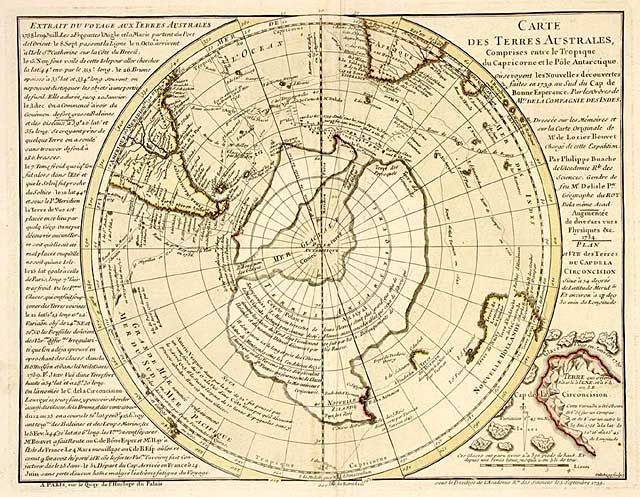
PHILIPPE BUACHE
Link to site.
There is a lot of info with this map at the sit and they say this is used by Graham Hancock .
Link to the full screen size of Piri's map that shows a piece of Antarctica.
This one is also weird and a lot of text explaining why.
Mysterious Mapmakers: Exploring the Impossibly Accurate 16th Century Maps of Antarctica and Greenland
Must read.
No comments:
Post a Comment